Plan Elements and Exhibits
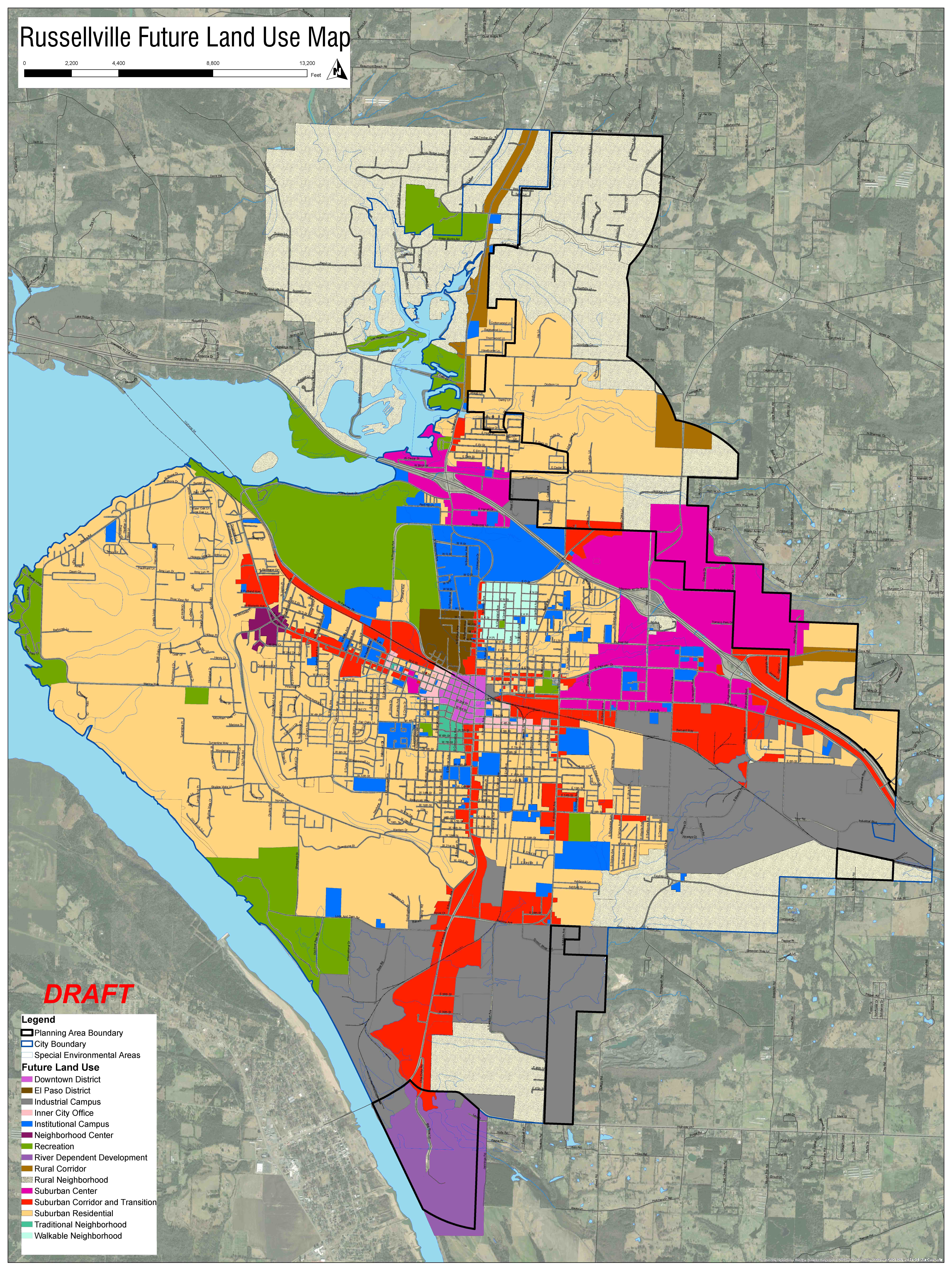
Future Land Use Plan
The Future Land Use Plan balances the existing development patterns with desired patterns of development for the future. The proposed land use plan capitalizes on the existing strengths of the City while charting a course for more flexibility in development types and focusing on infill development to help retain a strong economy and housing market interior to the City.
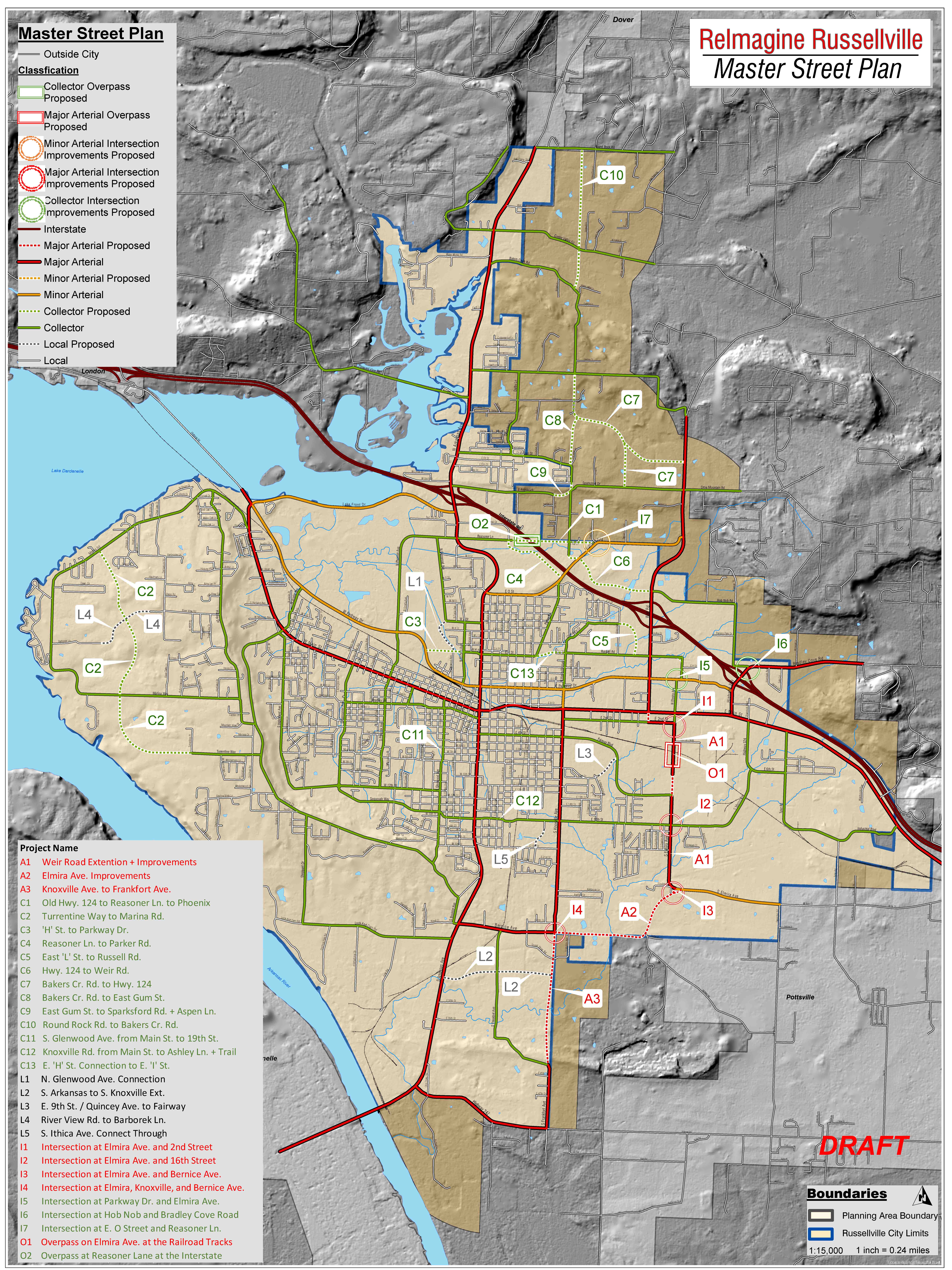
Master Street Plan
The City has an existing strong network of City, State, and Federal roadways that are a large part of what makes Russellville a desirable place to live, work, and invest. With growth and time, changes are needed to assure Russellville’s roadway system is strong and connected to keep the economic engines in your community running. This updated Master Street Plan accomplishes that by identifying key areas needed for future extensions, intersection improvements, overpasses and other roadway improvements. These improvements will help to relieve congestion and plan for efficient growth and improvement of your roadways system over time.
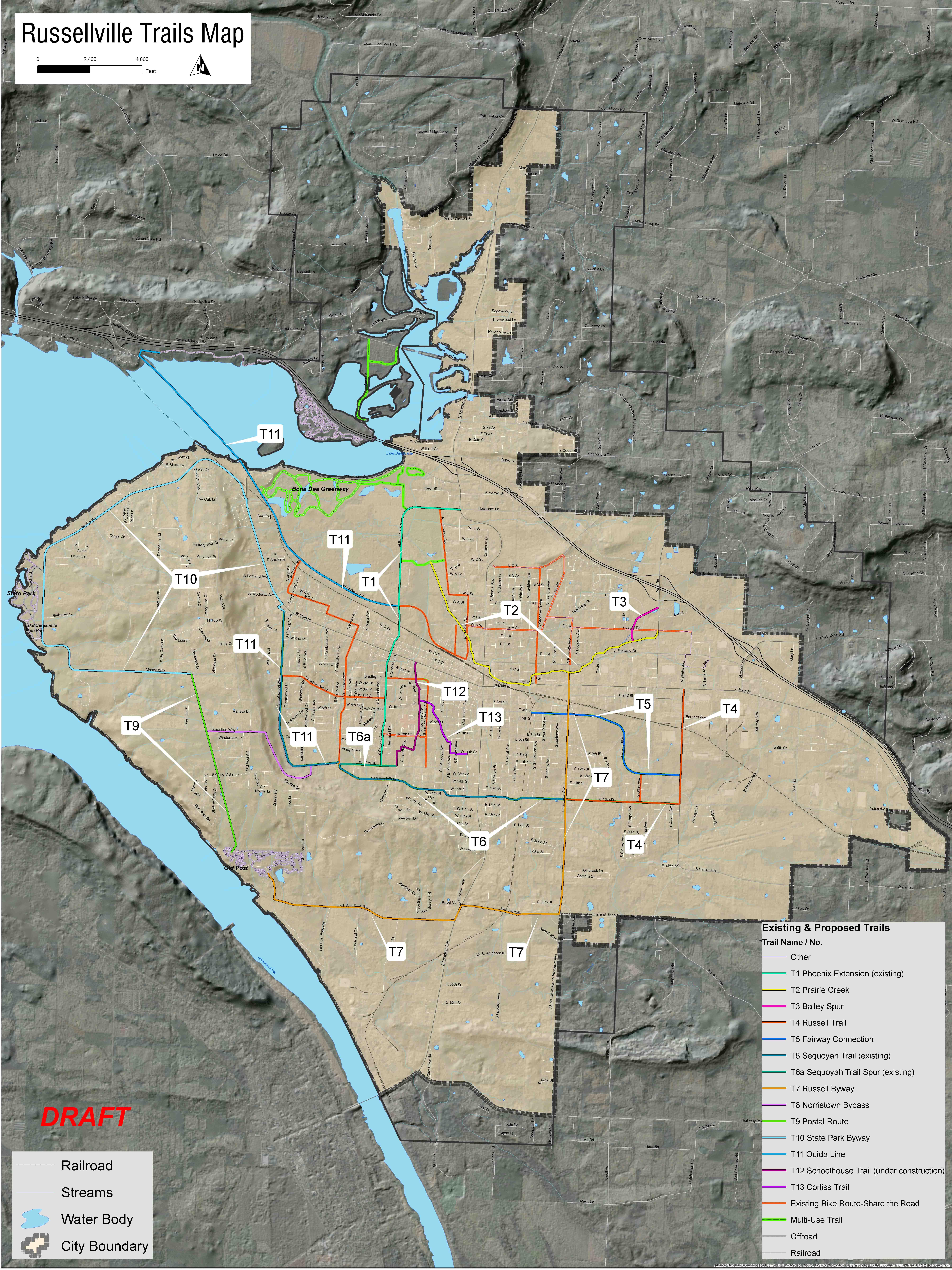
Recreation Network Planning
In the recent decade, local quality of recreation has become a key attribute sought after when choosing a community to call home or in which to start/move a business. Trails and parks are a large component of the local recreation opportunities.
The City of Russellville’s Trail Committee has been working diligently to complete an update for the trail system for the City. All elements of the City’s Trail Committee’s plan are being successfully integrated into this proposed plan. Additionally, this plan will reference your Parks Department’s new park plan for the City.
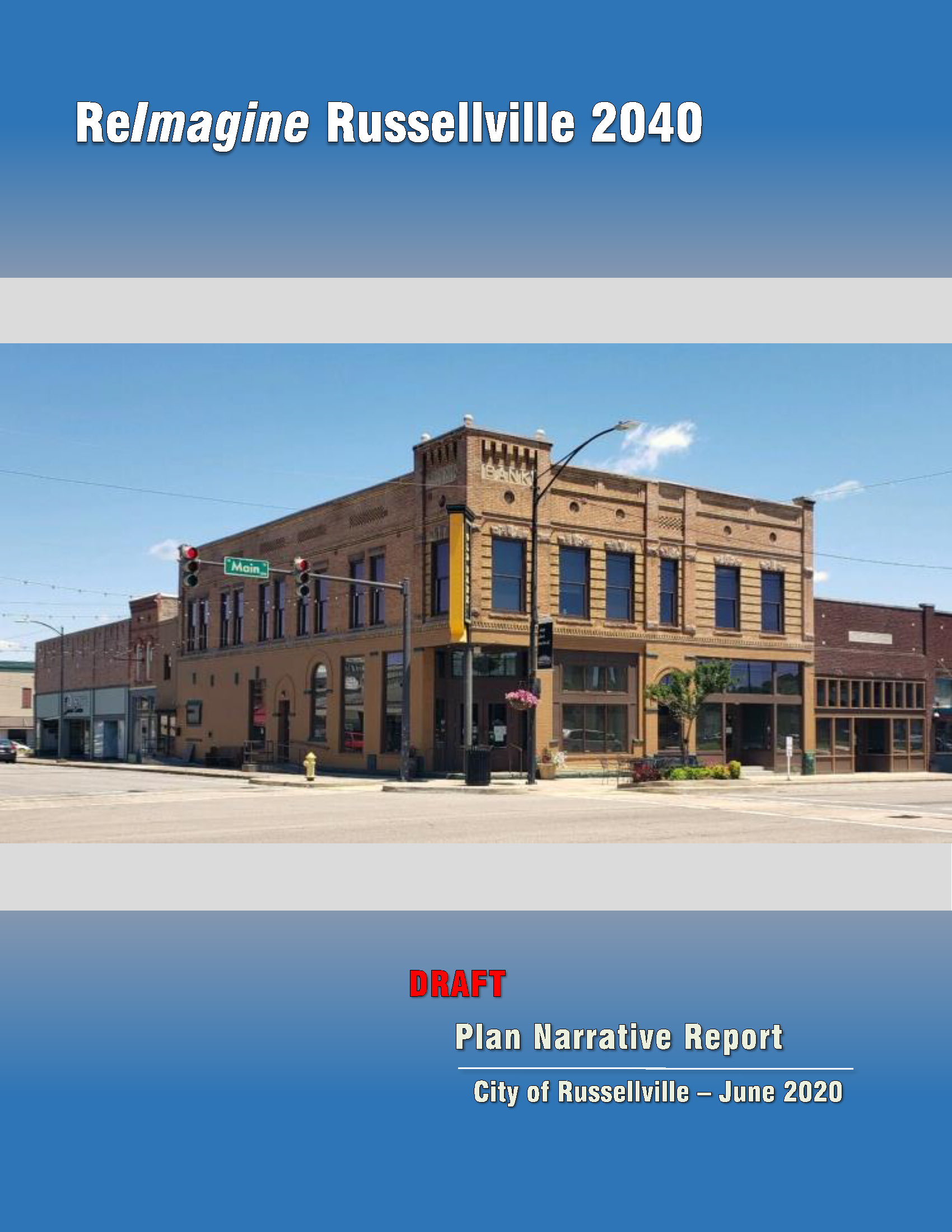
Comprehensive Plan Document
The ReImagine Russellville 2040 Comprehensive Plan document covers all of the previous elements described, as well as the history, demographics, analysis of existing conditions and developments, and many other factors that provide the basis for decisions made in the comprehensive plan.


